

Using remote sensing technology to monitor birds at offshore wind farms
An overview of radar, camera, acoustic, and tagging technologies for studying birds offshore

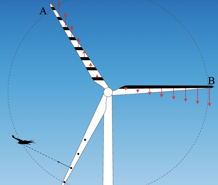
Offshore wind is seen as a critical source of energy to help Europe achieve net-zero emissions by 2050 as part of the European Green Deal. Understanding offshore wind energy impacts on birds is important due to unknown effects from collisions with blades and displacement from preferred habitat. These impacts are especially problematic given that many seabird populations are undergoing steep declines across the globe, and additional impacts from collisions and displacement could exacerbate these declines.
The Offshore Renewables Joint Industry Program (ORJIP) for Offshore Wind, in collaboration with others, published a report on the available technologies for surveying birds offshore at wind facilities. Remote monitoring technologies are particularly important due to the difficulty and expense of human observation offshore. The use of different sensor technologies allows detailed data collection on bird behavior within and around wind facilities 24/7/365, which would not be possible with traditional human data collection.
Available technologies for monitoring birds offshore
There are four main bird monitoring technologies that are commonly used offshore, including
- Radar
- Visible-light and thermal cameras
- Acoustics
- Tracking GPS or radio-tagged birds
The ORJIP report profiles both the available technologies and the commercial services that offer them for sale. However, this article will focus on the technologies themselves, as the commercial options are beyond the scope of this review.
Radar
Radar can be used to map flight tracks and trajectories of moving targets at large scales, such as birds. Individual birds can be detected out to a few kilometers, and flocks of birds can be detected out to over 10 kilometers. Some radar units can also track individual bird targets. However, radar tracking will fail if there are structures between the radar and the tracked target.
Radar is also useful for studying birds offshore because it can operate continuously throughout the day over large areas and in most weather conditions (clutter from waves and precipitation can degrade radar data, and high winds can damage radar equipment). Additionally, horizontal and vertical radar units provide flight height and flight direction information, which is useful for understanding collision risk. Flux rates and the proportion of birds at collision-risk height can also be estimated, but direct collisions cannot be measured using radar technology alone.
The main downside of radar is that it cannot reliably detect collisions, and species-specific information is imprecise and difficult to infer from radar tracking data alone. Pairing radar data with in-field observations can provide some species specificity; however, this will mostly be limited to daytime observations. Radars also often have trouble tracking targets or seeing objects that are very close to the radar system. This limitation can restrict radar’s ability to study bird behavior at smaller scales around individual wind turbines.
Cameras
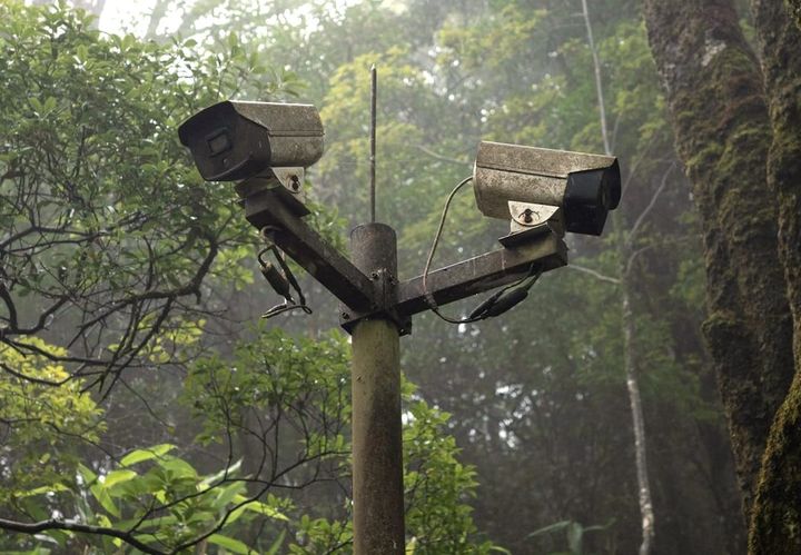
Thermal and visible-light cameras can record bird and bat interactions with wind turbines and can address many of the limitations of radar studies. Visible-light cameras have the added benefit of recording species-specific information, although they cannot do so very well at night. Thermal cameras can operate in all weather conditions; however, identifying species is challenging due to the lack of detail and color information. Some species with distinctive silhouettes (e.g., Magnificent Frigatebird) can still be identified with thermal cameras.
Because radar sensors can miss targets close to the sensor, radar sensors are often combined with cameras to provide comprehensive macro-, meso-, and microscale data. Radar is often used as the trigger to start camera recording, and cameras can detect targets up to several hundred meters away, depending on target size.
When combined with artificial intelligence, cameras can even track individual targets to estimate flight behavior and flight paths, either when paired with radar or when used alone. Artificial intelligence can also be used to identify specific species of interest, if suitable training data are available.
Acoustics
Acoustic sensors can detect bats and vocalizing birds that pass through the airspace above the microphones. Additionally, acoustics can be installed on rotor blades to detect vibration signals during collisions between birds and bats and the turbine blades. Despite the flexibility of acoustics, sensors should ideally be paired with other data collection methods to account for birds that pass through the area without vocalizing or bats that pass outside the microphone’s cone of detection.
When recording bird detections in the airspace above the microphones, acoustic detectors are useful for identifying species and for obtaining measures of activity. Acoustics cannot provide an absolute number of calling birds because many birds don’t vocalize, and it is impossible to identify the number of individual birds calling. The detection range of acoustic microphones varies, but calls from songbirds such as thrushes and blackbirds can be detected up to 100 meters, depending on environmental conditions and call volume.
Acoustic microphone placement is critical, as background noise can limit the ability to obtain high-quality recordings and identify species. To the extent possible, microphones should be placed away from environmental and structural noise sources so recordings are as clear as possible.
For acoustic analysis, some level of automation is possible. There are software packages, such as AROMA, which help to separate calls from background noise and identify species composition. Additional programs, such as MATLAB, can be used to match audio calls to a flight call library using an algorithm to speed up analysis; however, all calls must be manually reviewed to ensure the accuracy of any automated identifications.
Acoustics can also be used to detect impacts on blades without costly impact detection systems. Impact signals are transmitted from the rotating blades to a base station to record the impact event. This technology is novel and not well tested, and it is unclear how it will function in adverse weather and distinguish between impacts and precipitation.
Animal tracking and tagging studies
Animal tracking studies use radio-frequency or GPS tags attached to birds or bats to follow movements at large scales. These tag types vary greatly in cost and in the species for which they can be attached, depending on the tag’s weight and size.
Radio frequency tagging
Radio-frequency tags can be detected by handheld devices or by a Motus base station. For proper reception using small handheld devices, the tag’s range should be within 1 kilometer. With larger base stations and large antenna arrays, the detection range could be anywhere from 2–20 kilometers. Conducting observer-based telemetry surveys by boat or plane can help supplement location data collected by automated radio towers and handheld devices. The biggest limitation of using radio tags offshore is the limited number of receivers installed on offshore structures, which will limit the ability to detect tagged birds.
Tags should be less than 2% of the bird's body mass to avoid any adverse effects of additional weight on flying behavior. Attaching tags to the back results in fewer adverse effects on birds compared to attaching tags to leg bands, which can cause injuries and reduce body mass. The average lifespan of a back-mounted tag varies by material; however, it can be extended with a combination of adhesive and subcutaneous structures, as well as larger battery sizes, when safe for the birds.
Radio tag data is uploaded to the Motus website to determine species identifications for each tag number. Flight paths can be inferred by examining detections among different receiving stations; however, precise flight tracks are difficult to determine using Motus technology. Assuming enough receivers are deployed offshore, it might be possible to research macro-avoidance behavior at scale, thus informing collision risk models.
GPS Tagging
GPS tags provide precise location information on birds, allowing for a detailed understanding of flight tracks and flight altitude. GPS devices can be set to record coordinates at wide or narrow intervals, depending on the desired precision and battery life. Power sources for GPS tags can be either batteries or solar panels. GPS tags either transmit data in real-time or store it for later retrieval from a base station or by recapturing the bird. The main limitation of GPS tags is their weight, making them unsuitable for small birds. Tags typically have a lifespan of one to two years. Solar-powered tags can recharge the battery and extend the tag’s lifespan. Accuracy is typically within 10 meters.
With respect to offshore wind, GPS tags are particularly useful for evaluating macro-avoidance and meso-avoidance. Birds avoid the wind farm at different scales, and these avoidance data are particularly useful for informing collision risk models and seasonality in activity.
Sensor Fusion
Individual sensors each have substantial limitations in their ability to study bird behavior offshore. One approach to reducing those limitations is using sensor fusion or combining multiple sensors together to form a single cohesive monitoring system, with different sensors addressing the limitations of the other sensors. For example, radar technology could be integrated with thermal cameras and acoustics, thus providing detailed behavioral information around the wind turbines and species identification that would not be possible with radar alone. Additionally, radar systems could be configured, based on custom-defined control parameters, to trigger deterrent devices and on-demand shutdown of turbines if desired.
Commercial Offshore Monitoring Technology Solutions
Numerous commercial solutions are available that provide one or more of the technologies described above. It is beyond the scope of this post to describe all those technologies, as they are comprehensive and constantly evolving. It would be challenging to keep this post updated with all the new solutions. Therefore, readers can be directed to the comprehensive report on which this post is based if there is interest in understanding the commercial options available.
References
Croxall, J.P., Butchart, S.H.M., Lascelles, B., Stattersfield, A.J., Sullivan, B., Symes, A & Taylor, P. (2012). Seabird conservation status, threats and priority actions: a global assessment. Bird Conservation International 22(1):1-34. https://tokyo.birdlife.org/sites/wp-content/uploads/2012/03/Croxall-et-al-2012.pdf
Jak Nicholls, A., M. Barker, M. Armitage, and S. Votier. 2022. Review of seabird monitoring technologies for offshore wind farms. Offshore Renewables Joint Industry Programme. https://www.carbontrust.com/our-work-and-impact/guides-reports-and-tools/review-of-seabird-monitoring-technologies-for-offshore-wind-farms


Comments ()